Hurricane Karina Strengthens to Category 4 as Swells Head Toward Southern California

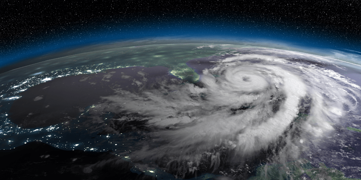
Hurricane Karina strengthened into a powerful Category 4 hurricane on Monday, August 31, 2026, as it moved westward across the open eastern Pacific Ocean. While the storm remained far from the United States mainland and was not expected to make landfall in California, its large swells were forecast to affect portions of the Southern California coastline during the first part of the week.
According to the National Hurricane Center, Karina was located more than 1,000 miles west-southwest of the southern tip of Baja California on Monday. The hurricane was moving west at approximately 9 mph, with maximum sustained winds near 140 mph. There were no coastal watches or warnings in effect for California.
The storm's development became one of the notable weather events in the eastern Pacific as August came to an end. Karina had strengthened considerably over a relatively short period, progressing from hurricane status to a major hurricane and eventually reaching Category 4 intensity.
Karina Remains Far Offshore
Despite the hurricane's strength, its distance from the California coast is an important part of the current situation. Karina was traveling over open ocean and was not forecast to directly affect the United States with hurricane-force winds.
The primary concern for Southern California was expected to come from the ocean rather than from wind or rainfall. Large swells generated by Karina were forecast to spread northward toward Southern California, potentially producing stronger surf and hazardous rip currents along exposed beaches.
These conditions can develop even when weather on land appears relatively calm. Distant tropical systems can generate long-period waves that travel hundreds or even thousands of miles before reaching the coast.
For Southern California residents and visitors, that means the presence of sunny skies should not necessarily be interpreted as an indication that ocean conditions are safe.
Potential Impact on Southern California Beaches
Southern California's coastline is heavily used during the final weeks of summer. Beaches throughout San Diego, Orange County, Los Angeles and Ventura counties attract swimmers, surfers and visitors, making changes in ocean conditions particularly important.
Karina's swells could produce larger breaking waves and stronger rip currents in exposed areas. Rip currents can pull swimmers away from shore and become especially hazardous when ocean conditions change quickly.
Beachgoers should pay attention to posted warnings, lifeguard instructions and local surf conditions. People who are unfamiliar with an area should also avoid entering the water when conditions appear unusually rough.
The potential arrival of Karina-generated swells demonstrates how tropical weather systems can affect California without approaching the state directly. The effects of a distant hurricane may be felt primarily through the ocean rather than through traditional storm impacts such as heavy rain or damaging winds.
A Rapid Rise in Strength
Karina's intensification has been one of the defining characteristics of the storm. The system developed into a hurricane before strengthening further into a major hurricane.
By Sunday, Karina had become a Category 4 storm, with maximum sustained winds reaching approximately 145 mph. It remained a powerful hurricane as it moved farther west over the Pacific on Monday.
The storm's strength also contributed to significant wave activity over the open ocean. Large seas associated with a powerful hurricane can generate swells that continue traveling outward from the storm even as the hurricane itself moves away.
Forecast conditions can change as a tropical cyclone moves through different areas of the ocean. Its intensity can increase or decrease, while its direction and speed can also influence when and where its swells eventually reach coastal areas.
No Direct California Landfall Expected
For California, the most important distinction is that Karina was not forecast to make a direct landfall in the state.
There were no hurricane watches or warnings in effect for Southern California, and the storm remained well offshore. The principal concern was therefore the potential for elevated surf and rip currents rather than a direct tropical cyclone impact.
Residents should continue relying on updated local weather and beach forecasts if they have plans near the ocean. Conditions can vary significantly between beaches depending on their orientation and exposure to incoming swells.
What Residents and Visitors Should Know
The arrival of Karina-generated swells is a reminder that California's coastal conditions can be influenced by storms far out in the Pacific.
People planning beach activities during the first days of September should check current surf conditions before entering the water. Visitors should follow lifeguard instructions and posted warnings, particularly at beaches where waves or currents appear stronger than normal.
Those who encounter a rip current should avoid attempting to swim directly against it. Instead, they should remain calm, conserve energy and follow established water-safety guidance, including swimming parallel to the shoreline when possible until they are out of the current.
For most Californians, Karina does not represent a direct hurricane threat. Its significance lies primarily in the unusual strength of the storm and the potential effects of its ocean swells along parts of the Southern California coast.
As August ends and the Labor Day period approaches, the storm provides a timely reminder that Pacific hurricanes can influence California's beaches even when they remain far offshore. Monitoring local coastal conditions will be particularly important for anyone planning to spend time in the water this week.

Golden State Review Contributor
Golden State Review Contributor
This article features branded content from a third party. Opinions in this article do not reflect the opinions and beliefs of Golden State Review.
This article features partner, contributor, or branded content from a third party. Members of the Golden State Review editorial staff were not involved in the creation of this content. All views and opinions are those of the contributor alone.